Not all 8 Hour Hikes are Created Equal
October 2025 - Spanish Pyrenees
We (read: I) chose the day’s hike from a small booklet that came with a map we bought. The booklet is filled with interesting looking routes all illustrated with topographic maps and lots of useful information. All very lovely looking. However, hiding amongst these hikes was one with an unusually scant description. My eye was drawn. Just a few paragraphs. All in Spanish, but no need to translate, all I needed was to know that it was a mere 8.5 miles (12 km) so, how hard could it be? I couldn’t help noticing however that it suggested this hike would take around 8 hours. Must be a typo. Clearly this was the route for us.
It all starts with a single step.
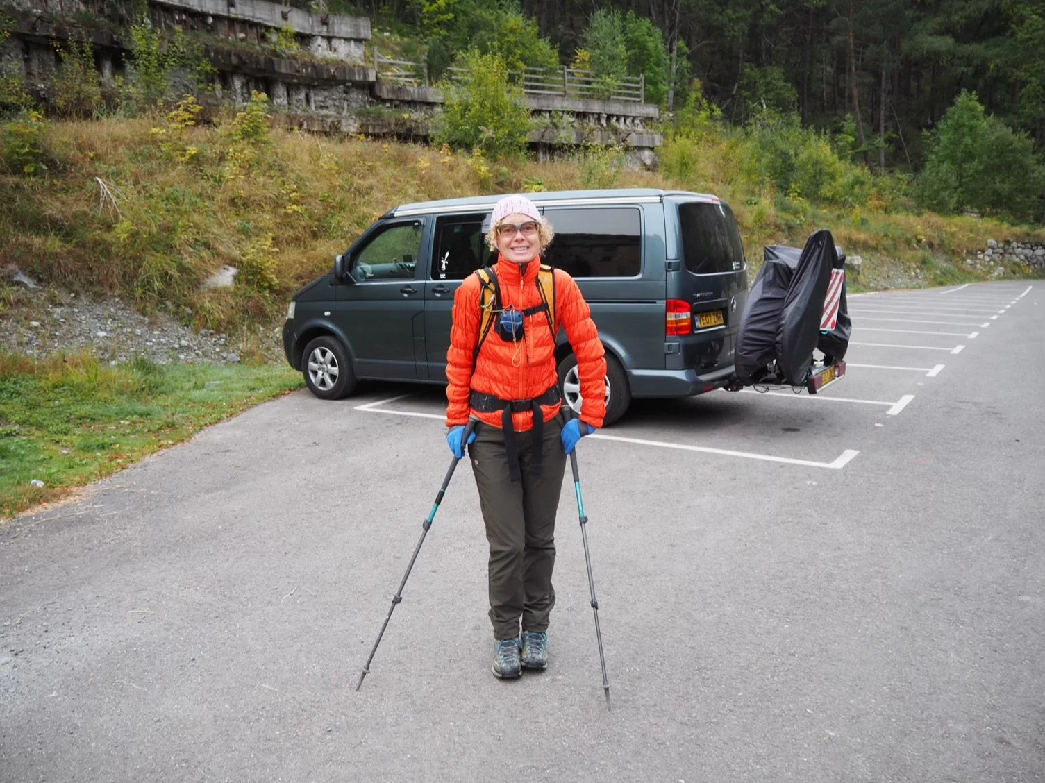
Little does Mrs P know that she won’t be seeing Gandalf (our campervan) for another 10 hours.
The hike starts near to a very posh hotel at the old spa resort of Banos de Panticosa, 1,630 metres (5,350 ft), where we parked young Gandalf our beloved campervan.
According to the description the route loops up over a mountain pass that may (or may not) be called Pena Xauns at 2,800 metres (9,000 feet). To be honest, it was all a bit vague.
The map simply says “Here be Deamons.”
What could possibly go wrong?

Mrs P, wending her way up (and up)
We started in the cold of early morning and were soon trudging up steep switchbacks beside a beautiful cascading watercourse. We only saw 5 other people on the first section up to a mountain hut at 2,000 metres. They were to be the last people we saw.

The Regugio de los Ibones de Bachimaña (2,000m)
Beyond the hut the main (read: sensible) route continues up the valley. Ours heads up that rocky, pointy thing in the background of the photo.
It was a seldom travelled path, rather vague on the ground and quite tricky to follow requiring occasional use of the backup Garmin.
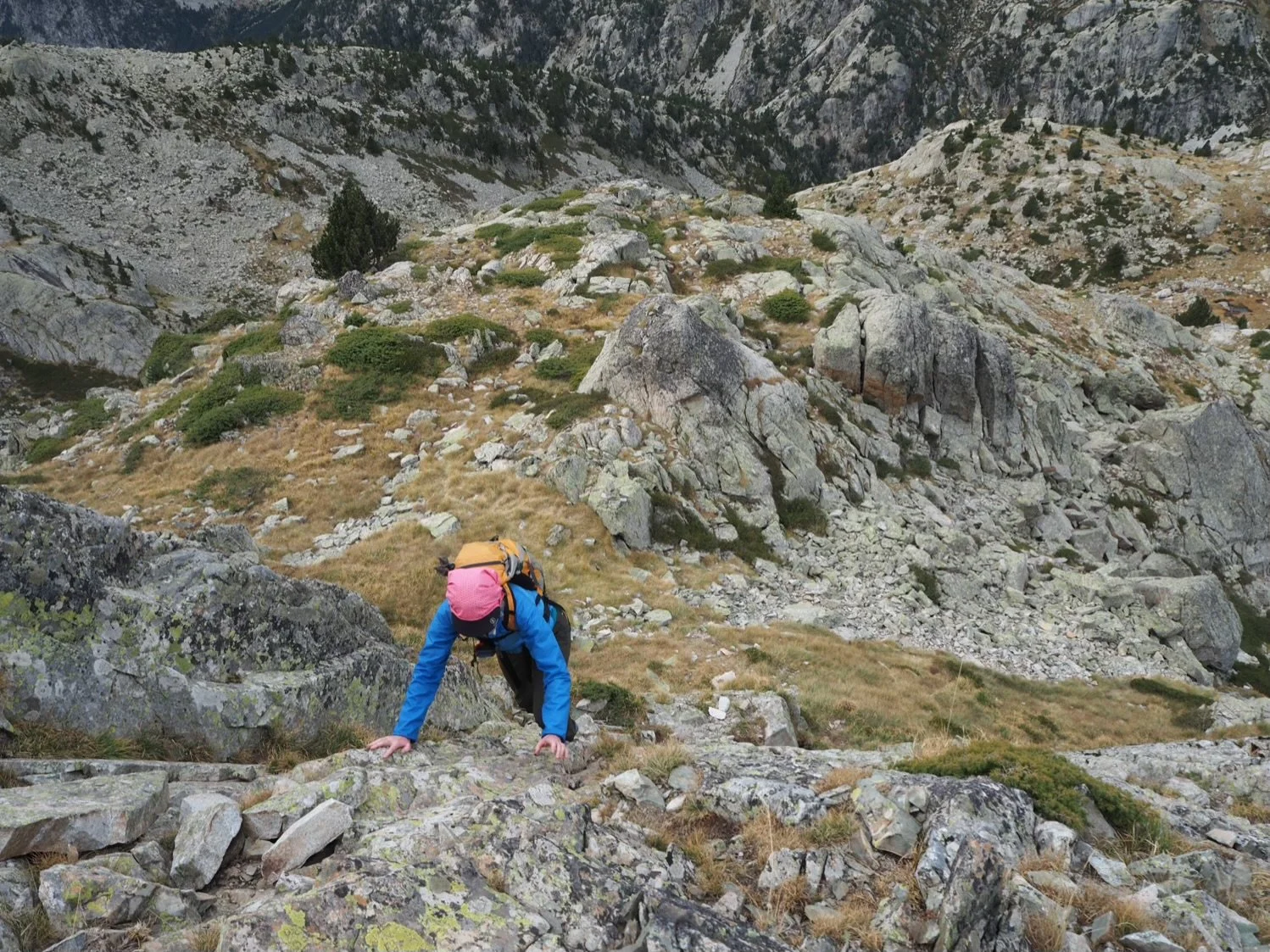
Soon it became a bit ‘hands on’

But who doesn’t love a bit of scrambling?
So far, all was as expected, a lovely mountain walk/scramble in a stark, rocky wilderness surrounded by 360° of serious geology.
Looking down on the refuge (for those with good eyes)

Time for a spot of lunch
After lunch a mere 100 metres (300ft) of ascent stood betwixt us and the col (pass). After that it would be downhill all the way. Simple.
And then we hit the first boulder field.
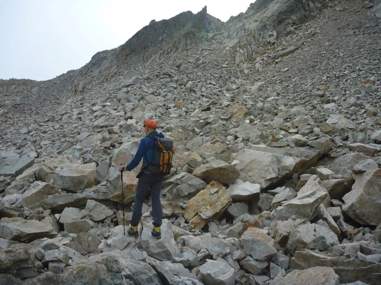
Me, contemplating the boulder field of doom.
Now, Mrs P and I have encountered a lot of boulder fields in our time, so we knew what to expect. Misery.
For those of you who don’t know, boulder fields were created by vindictive, angry God or, as some would have it, the freeze thaw/ fally down mountain geology thing. I know which I believe.
Here is a brief geology lesson. Imagine said angry God taking mighty hands full of boulders the size of cars, buses, trucks etc. and hurling them with some force at a mountain. Any boulders that look stable he/she/multi-headed weird monster thing then carefully tilts so that they rock dangerously when more than the weight of a tiny mouse attempts to cross them. Large people swallowing gaps are then added and the process repeated for many kilometres.

Negotiating with geology is a losing battle
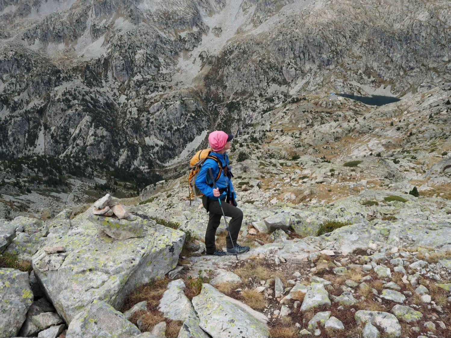
Accompanied by some light high-altitude gasping, we eventually made the col/pass at 2,800 metres and after a number of false turns, managed to find a sort of trail heading vaguely in the right direction. For a while all was fine and hunky dory, but we could see acre upon acre of boulder fields ahead.

Ibon (lake?) de la Basa Superior as seen from one of the easy bits
Soon we were back into a much bigger boulder field. To walk this section on an easy track would have taken maybe an hour, but with navigation and route finding difficulties an hour saw us only a short way through the boulder field of doom part 2.

Mrs P slowly receding into the distance

An easy bit. No photos of the difficult bits. Too many hands required.
The main problem with this type of terrain is not the technical and sure footedness that is required but in finding a decent passage from one side to the other. One that doesn’t end up in a hole or in a dip blocked by impenetrable boulders the size of houses. Yes, there is a line on the map, but it is of little use. The best navigation aid is to follow cairns (small piles of stones) left by previous travellers and hope that they weren’t erected by the ones who were lost. Which all too often they were and led to backtracking.
Picture the scene. You are balancing precariously by the last visible cairn and looking for the next one. It could be 5 metres away or 150. It could also be anywhere in any direction.
With that in mind study the following photo carefully. A prize (a rubbish one admittedly) to anyone who can spot the next cairn even with the handy hint red square.

A cairn, a cairn. My kingdom for a cairn
The next photo zooms into the red square area. Where you may finally spot the cairn helpfully outlined in red. A pile of rocks within a pile of rocks to guide you through the pile of rocks.
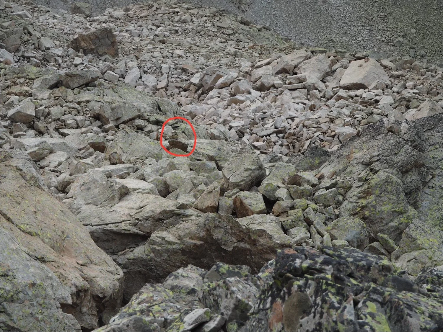
Between a rock and, well another rock
Incidentally, twenty percent of the time this cairn is not going the right way but was placed by some well meaning person who was just as lost as you are.
Onward. Move a bit. Stand and stare. Move a bit… backtrack a bit…
We played this game for hours.
Meanwhile our vindictive, but now highly amused Deity looks on.

Finally…
Finally our Sisyphean trial (look it up) was over and we left behind the boulders. Sadly though we have lost little altitude and still have 600 metres (2,000 feet) of descent ahead of us.

Mrs P enjoying a spot of greenery
In defiance of both the Gods and Geography we finally made it back to the van at 6.30pm after 10 long hours.
Don’t worry about us spoiling the Gods’ fun though. We’d do it all over again in a heartbeat.
Type 2 fun maybe, but great fun nevertheless.